
Sources for Fontana Previous Residents
Previous residents of a Fontana address appear in different record layers, and each layer has its own date range and access rule. Start with the parcel and deed trail for ownership history. Add directories and census schedules for household presence, then use permits, newspapers, obituaries, or probate to explain a move, a death, or a transfer. The table keeps those roles distinct and marks the gaps that require a counter or library inquiry.
| Source | Years It Covers | Where Held | What It Shows |
|---|---|---|---|
| Recorder official-record index | 1925-present | ARC online index, copy order, or counter | Grantors, grantees, document title, date, number, and deed clues |
| Recorder house-research guidance | 1958-present online guidance; pre-1958 decade microfilm | ARC index and office or archival research | Earlier grantor-grantee work, with a cutoff discrepancy to preserve |
| Assessment values | 1978-present | ARC Parcel Access | Parcel valuation continuity, not a complete ownership history |
| Assessor lot and parcel books | 1895-about 1950 | County archives or counter inquiry | Taxpayer, lot or section clues, and land or improvement values |
| City and reverse directories | Exact Fontana run unverified | Lewis Library and Fontana Historical Society inquiry | Address-to-household clues when a volume exists |
| Federal population census | Through 1950 | NARA, partner databases, or library access | Names, relationships, ages, and enumerated-place clues |
| Sanborn maps | Fontana sheets not confirmed | Library of Congress collection | Building footprint, use, and address continuity if a sheet covers the parcel |
| Permits, obituaries, and probate | Series-specific | Fontana Development Services, archives, newspapers, and court files | Physical change, relatives, heirs, and events that close a household trail |
For an older address, the most useful starting point is still the modern parcel clue. It gives the legal description that can be matched against recorded instruments, while the census and directory layers help answer who was present. A source gap is not a reason to fill in a name from assumption.
Start With a Fontana APN
Carry the APN and legal description backward before searching for previous residents. The San Bernardino County Assessor Property Information service can connect a situs address to the county parcel map, assessment context, and a current displayed owner clue. Record the APN, subdivision or lot clues, and the date of the search. Then use those details to test a deed rather than treating a street string as permanent.
The legal description is especially valuable when a street label, postal city, or parcel display changes. It can identify the same lot through a deed chain even when the address wording differs. The displayed owner is a lead for the recorder search, not a title determination. Assessment values reach back to 1978, while the older lot books provide a separate historical layer. For current parcel work across a whole street, the Fontana street directory address workflow keeps the parcel walk distinct from a single-house history.
Insider tip. Write the APN and legal description at the top of every deed note. Those clues usually travel farther backward than a postal address.
Note: A parcel identifier is a research bridge, not evidence that a named person lived at the Fontana address.
Follow the Fontana Deed Chain Backward
The San Bernardino County Recorder does not search ownership by street address. Begin with the owner clue from Parcel Access, search that name as a grantor or grantee, and isolate the acquisition deed by its parties, date, document type, and legal description. Read or order the instrument before accepting that it concerns the target parcel. A common name can produce a convincing but unrelated hit.
- Search the address or APN in Parcel Access and copy the APN, legal or subdivision clues, and current displayed owner information.
- Search that owner in the recorder index as grantor or grantee. Look for the acquisition deed and note the document number, recording date, title, and indexed parties.
- Read or order the deed. Capture the grantor, grantee, legal description, and any parcel or instrument reference that connects it to the target.
- Search the seller as an earlier grantee. Match the legal description and document trail before accepting a same-name result.
- Repeat backward until the online boundary is reached, then move to the decade microfilm, deed books, or counter route described by the county.
- Grantor and grantee
- The grantor transfers an interest in the recorded instrument; the grantee receives the stated interest.
- Chain of title
- The linked sequence of recorded transfers used to follow a parcel from one instrument to an earlier one.
- Legal description
- The deed's formal parcel description, which can be more stable than an address label.
- Index versus image
- The index identifies a recorded document; the image or certified copy contains the instrument's actual text.
A deed chain traces recorded interests, not every person who lived at an address. Pair it with a directory or census source before calling a named party a previous resident.
Fontana's 1925 and 1958 Divide
Fontana deed research has an important catalog mismatch. The recorder's official landing page states that the document-name index reaches from 1925 to the present. County house-research guidance describes online grantor-grantee work from 1958 to the present and sends pre-1958 searches to decade microfilm. Both statements belong in a careful plan. The earlier date may describe index coverage, while the later date describes the practical online workflow.
Do not silently choose one cutoff. Search the online index, try spelling variations, and then ask the Assessor-Recorder-Clerk which decade index or microfilm volume covers the gap. Public online records do not display document images. Images are available through the Hall of Records, the High Desert Government Center, or a copy order. This boundary is why a search for previous residents can stall even when the parcel and its modern owner are clear.
Note: The index date and the practical online research date describe different access claims, so preserve both in working notes.
Fontana Lot Books Before the Modern Roll
Assessor lot and parcel books from 1895 to about 1950 can add a taxpayer and land-history layer before online assessment values. Depending on the volume, the useful clues may include a lot and block, township, range and section, or other legal-description reference. Land, improvement, tree and vine, and water values can show how the parcel was described for assessment.
| Lot-book clue | What it can contribute to a Fontana address history |
|---|---|
| Taxpayer | A historical assessment name to compare with recorded parties. |
| Lot, block, or section | A legal or map clue that can bridge older descriptions. |
| Land value | Assessment context for the parcel's land at that time. |
| Improvement value | A development-date clue, not proof of a building type or a household. |
| Tree, vine, or water value | Agricultural assessment detail that can place the parcel in its earlier land-use setting. |
Use lot books as corroboration. The first improvement value may help date development, but it cannot identify a structure by itself. Compare the legal clue with a deed, map, census entry, or newspaper item. Online assessment valuation beginning in 1978 is useful for continuity, yet it does not replace the older books or establish a complete ownership chain.
Past Fontana Households in Directories and Census
Owners are only part of the previous-residents question. A city or reverse directory may place a household at an address for one edition, while the federal census supplies a household snapshot for an enumeration year. The exact Fontana directory publishers, annual run, and reverse-directory years were not verified. Ask Lewis Library and Technology Center or the Fontana Historical Society for a specific volume and its address-section key. The Fontana city directory collections overview keeps those shelf questions separate from the deed chain.
A practical pairing sequence is:
- Choose a known census or directory year and write down the address wording used there.
- Check the closest directory edition for a name at the address, then note any street or household variation.
- Compare the 1940 or 1950 census household with the directory entry and keep the enumeration place distinct from the deed owner.
- Read each volume's abbreviation key and record whether the entry is an address listing or a reverse address section.
- Use a newspaper, obituary, or probate file to explain a disappearance instead of assuming a move or death.
The National Archives identifies the 1950 census as the latest federal census currently public under the 72-year rule. A missing directory entry can reflect a skipped canvass, late move, name variant, or omission. It does not prove that the address was empty, and a directory name does not prove ownership.
Rosena to Fontana: Address Context
A Fontana house history may need more than one place name. Before San Bernardino County formed in 1853, the area belonged to an earlier Los Angeles County record path. A.B. Miller developed about 17,000 acres from 1905, and the agricultural and railroad settlement known as Rosena was renamed Fontana in 1913. Search both names when an older deed, map, or newspaper uses the earlier label.
Kaiser Steel arrived in 1942, Fontana incorporated on June 25, 1952, and the mill closed in 1984 before the site later became a speedway. Those changes matter only as address context: a parcel's land use can shift sharply while the lot and legal description remain the stronger bridge. The City of Fontana history timeline provides a local chronology. It does not replace the recorded instrument or census evidence.
Fontana Maps, Permits, and Missing Years
Sanborn fire-insurance maps can help with building footprint, use, and address continuity when a sheet covers the parcel. Fontana-specific sheets were not confirmed in the Library of Congress online collection, so a map should be treated as a possible lead rather than a promised source. Search the Sanborn map collection and ask the library or archives whether a local copy or index exists.
Permit records add another kind of date. Fontana Development Services may hold project addresses, applicants, contractors, and inspection history where public. The exact online start year was not located, and a postal Fontana address may send the request to the county when the parcel is unincorporated. A permit can date a remodel, build, or demolition, but it does not establish who lived at the property. Keep physical-change evidence beside, not inside, the household trail.
The Fontana Deed Letter by Mail
The San Bernardino County District Attorney's Real Estate Informational Letter Program adds a useful modern story to deed research. After selected recorded filings, the program mails owners and includes the first two recorded pages. A letter can alert an owner to a filing and point to a document number, but it is not a complete title history and does not identify every prior household.
Use the District Attorney's real-estate-fraud information to confirm the program and compare any notice with the parcel, parties, and recording details. The same cross-check helps identify an over-priced deed-copy solicitation or a suspicious filing. Keep the alert as one event in the chain, then obtain the underlying instrument from the recorder.
Fontana Recorder Copies and Lawful Limits
The San Bernardino County Official Records service supports online index research, online copy orders, mail requests, and in-person inspection. Mail requests use the county copy-request form and a check or money order. Images can be inspected at the Hall of Records or High Desert Government Center. The recorder subscription terms describe a separate image and index service for batch users. Maps may be purchased at the Hall of Records, and appointments are strongly encouraged and prioritized. The assessor-recorder-clerk office is at 222 W. Hospitality Lane, San Bernardino, with Assessor Services at (909) 387-8307 and Recorder-Clerk Services at (909) 387-8306.
Current research note for 2026: the official-records material lists standard mail at $3.50 and priority mail at $29 effective July 1, 2026. Check the linked county page before sending money because schedules can change. The recorder self-service image shows the gateway that starts the index route; it is not a substitute for reading the recorded document.
The San Bernardino County recorder self-service gateway is the documented starting point for accepting the disclaimer and searching the index. It is the clearest visual reference for a previous residents deed search.
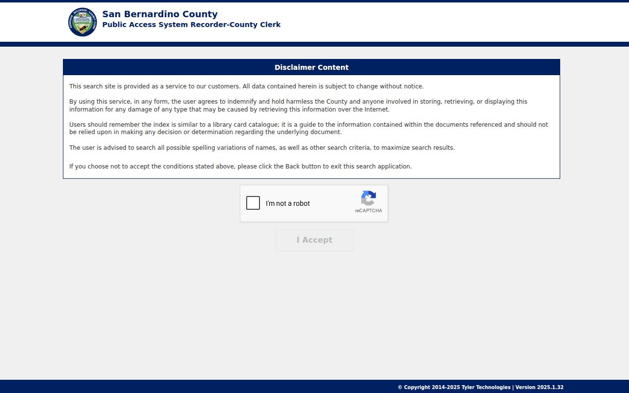
The gateway helps locate a candidate instrument. The copy, counter, or image route supplies the text needed to compare grantors, grantees, and legal descriptions.
Lawful house history. Previous residents research belongs to family history, property history, and personal curiosity. Do not use a record trail to stalk, harass, intimidate, or harm a living person.
Note: Verify current copy charges and image availability with ARC before mailing a request or planning a counter visit.